Weather
Climate: New Hampshire, like all of the New England States, enjoys four distinct seasons.
There are exceptions, but in general terms the spring months are a bit chilly and often rainy, summers are mild and very pleasant, fall days are beautiful and brisk, while winters are cold and snowy.
The statewide average high temperature in July is near 70 degrees, while in January, high temps are usually near 20 degrees.
On average, New Hampshire receives nearly 45 inches of rainfall each year, with much higher amounts in the mountains. In the White Mountains, 200 inches of annual snowfall is the norm.
Land Forms
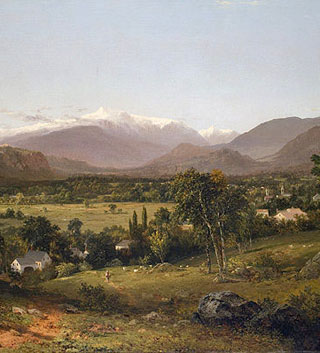
New Hampshire is dominated (south to north) by the White Mountains, a northern range of the Appalachians Mountains.
The major peaks of White Mountain range, a series of rugged mountains and narrow valleys, are found within the White Mountain National Forest. New Hampshire's highest point, Mt. Washington at 6,288 ft. is located in that forest.
It was at the top of Mt. Washington in 1934, that the world's second highest wind speed was recorded; an incredible 231 miles per hour.
The northernmost reaches of New Hampshire - along its Canadian border - are tree-covered forested lands, and home to logging and paper industries.
To the southeast of Concord, the Coastal Lowlands front its 13-mile-long Atlantic Ocean coastline.
By-products of the Ice Age, many deep, yet small, glacier-carved lakes are found within the state; Lake Winnipesaukee is certainly the largest of these.
The state is drained by numerous rivers. The most significant include the Connecticut, running along its entire western border with Vermont, and the Merrimack - the longest river (within) the state.
Mount Washington
Latitude and longitude
Latitude/Longitude: (Absolute Locations)
Concord: (capital city) 43º 20' N, 71º 53' W
Nashua: 42º 76' N, 71º 46' W
Concord: (capital city) 43º 20' N, 71º 53' W
Nashua: 42º 76' N, 71º 46' W
